Words from Wik

Sharing my Experiences

Friday, August 28, 2009

Following along Cho Oyu

This may or may not be my last post before we start going up the mountain, so I wanted to pass along the link for where you can keep track and follow along as we do our climb. You will have to go to the following address:

http://www.summitclimbnews.com/

Then click on the picture beside “Cho Oyu Autumn 2009” or something similar. The link is not up yet but should be up by the first or second of September when we all arrive and meet in Kathmandu. There’s usually an update every day or two, more frequently as we get closer to attempting the summit.

I will try and post an update with a permanent link if I get a chance. Otherwise wish me luck and see you after coming down!

**UPDATE** We are now almost all in Kathmandu, and the site where you can get updates on our progress is here.

posted by Wiktor at 17:02  

Thursday, August 27, 2009

Climbing the next one…

So with just barely having caught up on writing about my last summit on Aconcagua, I am heading off to climb yet another mountain! This one is, believe it or not, is higher than the last one. I’m flying to Kathmandu in Nepal and we’ll drive to China (Tibet) to attempt a climb of the sixth tallest mountain in the world, called Cho Oyu. It’s 8200m tall, 20km west of Everest (aparently you get some good views of Everest from the top!), if you want any more details just check Wikipedia here. I have been getting all my stuff ready in the last few weeks, have been training for months, and just lately (or maybe a long time ago?) I started eating like a pig to gain some weight so that I have more of it to lose while on the mountain.

I will post another entry in the next few days with a link to the SummitClimb News website, where they will post regular updates on our progress as we call in dispatches from a Sat phone while on the mountain. In the meantime, I will post a picture and below it our proposed itinerary, so if you want to know you’ll have a bit of an idea of what I am getting myself into. Enjoy the smileys!

Trying on the gear

Arriving in Kathmandu:

Sep 1) Arrive Kathmandu (1,300 metres/4,300 feet).
Sep 2) Hand over passport to China Embassy, begin processing of Chinese Visa. Training and equipment review at hotel in Kathmandu.
Sep 3) Receive processed visa from Chinese embassy. We may choose to depart Kathmandu for Tibet on this day;

Driving to Basecamp:

Sep 4) Begin Expedition! Bus to Zhangmu, Tibet (2500 metres/8,250 feet); drive to Nyalam (3,750 metres/12,400 feet).
Sep 5) Rest & Acclimatization in Nyalam (3,750 metres/12,400 feet). Walk in the surrounding hills, hang out in the Tashi Amdo teashop. Hotel.
Sep 6) Drive to Tingri at 4,300 meters/14,100 feet. Hotel.
Sep 7) Rest & Acclimatization in Tingri at 3900 metres/12,900 feet. Hotel.
Sep 8) Drive to Chinese Base, 4900 metres/16,000 feet, Camp.
Sep 9) Rest & Acclimatization at Chinese Base.

Moving to Advanced Basecamp:

Sep 10) Walk halfway to advanced base camp, camp at 5100 metres/16,800 feet.
Sep 11) Rest day & Acclimatization at “interim-camp” at 5100 metres/16,800 feet.
Sep 12) Walk to advanced base camp at 5600 metres/18,500 feet. Rest.
Sep 13) Rest & Acclimatization, training, and organization at advanced base camp.

Climbing Cho Oyu:

Sep 14) Walk to camp 1 at 6200 metres/20,450 feet, return to advanced base camp.
Sep 15) Rest in advanced base camp.
Sep 16) Walk to camp 1, Sleep.
Sep 17) Explore the route to Camp 2 at 6700 metres/22,100 feet. Return to advanced base camp.
Sep 18) Rest in advanced base camp.
Sep 19) Rest in advanced base camp.
Sep 20) Walk to camp 1 and sleep there.
Sep 21) Walk to camp 2 and sleep there.
Sep 22) Explore the route to camp 3 at 7400 metres/24,400 feet. Return to advanced base camp. Rest.
Sep 23) Rest in advanced base camp.
Sep 24) Rest in advanced base camp.
Sep 25) Rest in advanced base camp.
Sep 26) Walk to camp 1 and sleep there.
Sep 27) Walk to camp 2 and sleep there.
Sep 28) Walk to camp 3 and sleep there.

Summit Days:

Sep 29) Summit attempt.
Sep 30) Summit attempt.
Oct 1) Summit attempt.
Oct 2) Summit attempt.
Oct 3) Summit attempt, descend to camp 2.

Going Home:

Oct 4) Descend to advanced base camp, pack and prepare to depart.
Oct 5) Final packing, walk down from advanced base camp to Chinese base, drive to Tingri and spend the night.
Oct 6) Drive from Tingri to Kathmandu.
Oct 7) Celebration Banquet. Packing and final shopping in Kathmandu.
Oct 8) Say Good-bye to your new friends, Departure for home.

posted by Wiktor at 19:56  

Tuesday, August 18, 2009

Aconcagua: Descending

When we last left off, we were about to head down the mountain as some weather was coming in. I wanted to follow that post with an in-depth narrative of our descent all the way down the mountain. However, after considering what I wrote on the last post, I just couldn’t write anything that lived up to what I told there. So what follows are some of the pictures worth sharing and a brief description of each. If you want to see bigger pictures make sure to click on one of them to be taken to the gallery and maximise your browser for best quality.
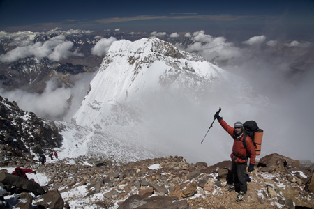
Click for full-size gallery. Ryan leading the way down, and you can see clouds starting to form behind him.

Ryan leading the way down, and you can see the clouds starting to form behind him.
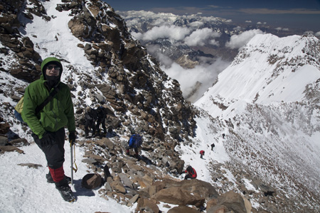
Click for full-size gallery. Me with the other face of Aconcagua visible in the back.

At this point I stopped to have my picture taken with the other face of Aconcagua visible in the back. One thing you’ll notice is that I don’t have my backpack, we had left them a little before the summit, so we are now on the way back to get them. You can see the line of people still making their way up, I am quite sure that we were the first group of people to head down that day.
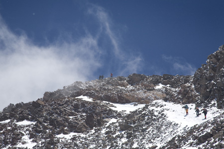
Click for full-size gallery. One last look at the summit.

After coming down a little more, we take one last look at the summit, where we can still see people posing for pictures or videos before the clouds come and swallow the view up.
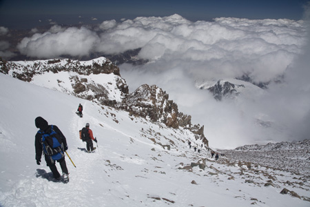
Click for full-size gallery. Emil behind Ryan working their way down.

Here we see Emil behind Ryan working their way down, where the clouds in the distance form a nice puffy texture of cotton candy that looks absolutely delicious! One thing I wanted to comment on here, coming down this mountain is a hundred times easier than going up. Now it is true that most climbing accidents happen on the way down, and you have to be very aware and cautious as you go down. That said though, there are no technical sections on this mountain that require that much skill, so it’s basically just a cautious walk down. Just thinking back to being there as it’s happening, the distance covered going down was unbelievably fast (compared to going up). This just shows how difficult it is to be going up at this altitude, the amount of energy required and the difficulty in being so high, as once your body doesn’t need to be huffing and puffing, things become a lot easier.
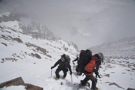
Click for full-size gallery. We continue to pass people on their way up.

As we descend lower and the clouds come up higher, we continue to pass people on their way up. The ones on this picture will likely still make it to the top, but won’t have any kind of view. We met people further down still, making their way up, that had absolutely no chance of making the summit with the way the weather was coming in.
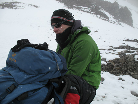
Click for full-size gallery. Tired, thirsty, cold.

By the time this picture was taken we were well within the weather system, and I had put my camera away. But Emil had his more handy, and shows the painful expression I had on my face from being tired, thirsty, cold, and generally not in a comfort zone. Thirst was the big thing, I was thirsty already on the way up, without enough water to quench it. It’s practically impossible to take as much water up with you as you would want to drink, as you end up losing through sweat and every single high-altitude breath. I had nothing to drink for the last bit of summiting and the entire way down.
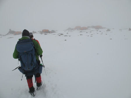
Click for full-size gallery. Our camp, shrouded in fog and falling snow.

We finally reached our camp, shrouded in fog and falling snow, but shelter none the less. It was quite a rewarding sight, as we had spent about 11 hours outside going up and down in the cold. I also want to mention the out-of-body feeling that I had on the last part of the way down. From the thirst and tiredness and the cumulative effects of the entire trip, on the way down I felt eerily not inside my own body. I felt as if I was looking down at myself in the third person, as you see me in the picture above, a disconnect between body and mind. Take that for what it’s worth! Once we reached camp 2 we drank, ate, drank, slept, more or less in that order. The thing with these summits is you get back mid-afternoon so there is still half a day of time before the sun sets. We rested and prepared all we needed to pack up and go down the next day, where we would go past camp 1, all the way to base camp.
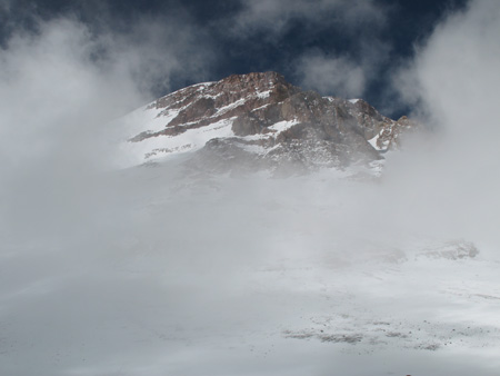
Click for full-size gallery. A glimpse of the mountain as it peeks out from under the clouds.

Here we catch a glimpse of the mountain as it peeks out from under the clouds, the last look we would get from that high up.
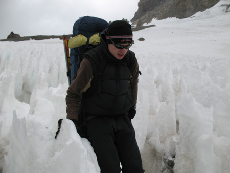
Click for full-size gallery. This part was not a walk in the park, mainly since we had to carry down in one go what we had carried up in several trips.

On the way down to base camp we passed camp 1 and spent one day descending what had taken us 6 days to ascend. On the picture above you can see that even this part was not a walk in the park, mainly since we had to carry down in one go what we had carried up in several trips. My bag was never fuller or heavier than on this day, you can see that my 95 litre bag is filled over capacity and the top compartment is extended to cover the top.

Once we got to base camp we passed on the normal camp meals and went to a “restaurant” for the most delicious plate of lasagna I have ever had! I ate every last crumb, licked up every last bit of grease from the plate. That’s the kind of appetite we all had for “normal” food!
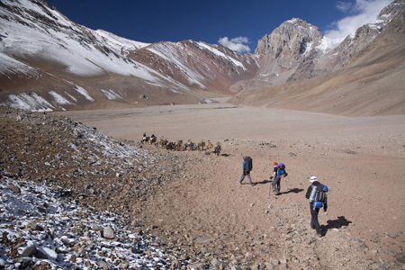
Click for full-size gallery. This is the start of a day during which we would walk 33 kilometers.

In the picture above we are about 20 meters into our trip from base camp to the lower camps. One difference you can see from previous base camp pictures is the amount of snow all around. This was the weather system we were in at the top, that it left snow all around the mountain. This is the start of a day during which we would walk 33 kilometers to the first camp we stayed at, Las Lenas (with the flush porcelain toilets!)
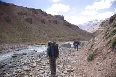
Click for full-size gallery. We took off our hikers and crossed this gentle-looking stream.

On this 33 kilometer day we would have to take off our hikers and cross this gentle-looking stream that was really not that gentle. But the feet sure felt good after their first wash in a couple of weeks!
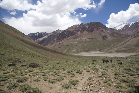
Click for full-size gallery. The point where we crossed the stream on mules almost two weeks ago.

Here we get to the point where we crossed the stream on mules almost two weeks ago. After crossing (this time on foot) we sat in the sun, let our feet dry, and relaxed while having lunch. After this stop the weather became bad again (as it had the first time we came to this spot two weeks prior, the beginning and end of our weather trend), and the rest of the way was a little more wet and windy.
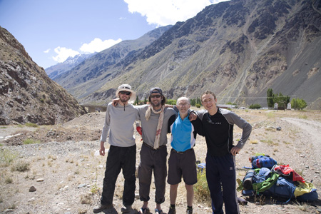
Click for full-size gallery. Last picture of the trip, the after picture.

Last picture of the trip, the “after” picture. Emil, Ryan, Kerry, and myself, with everyone that can grow facial hair showing it off proudly! While you can’t really see it in this picture, when I looked at myself in the mirror later that day I did not recognize myself. I had aged 10 years in two weeks. Also when taking a shower that day was the first time I noticed how much weight I had lost. It was the first time in my life I could actually feel all my ab muscles. I did not weigh myself so I cannot even guess how much I weighed, but I had an enormous appetite for months after (I was still eating big probably long after I had gained it all back!)

So that’s the story of Aconcagua 2009. Hope it shed some light on how exactly these trips look and feel. Take care, until the next mountain!

posted by Wiktor at 17:00  

Tuesday, August 11, 2009

Mountain Climbing Brain Damage

Another break from Aconcagua reporting, here is an article I found interesting on high-altitude mountaineering and brain damage. I will admit I was not too surprised by it as I’ve met many people that have mentioned this, however it’s interesting to see that it can be scientifically verified.

A new study of professional mountain climbers shows that high-altitude climbing causes a subtle loss of brain cells and motor function.
On scans, the climbers showed a reduction in both white and gray matter in various parts of the brain.
Six of the nine climbers had lower than average scores on the Digit Symbol test, which measures executive functions. Three out of nine scored lower than average on memory tests, while four scored below average on a visual-motor function test. The study authors noted that the results “are most likely to be due to progressive, subtle brain insults caused by repeated high-altitude exposure.”

To see the full article click here.

posted by Wiktor at 18:15  

Powered by WordPress