Words from Wik

Sharing my Experiences

Wednesday, March 31, 2010

News from Kathmandu

Just a quick update on how things have been going since arriving in Kathmandu. It’s much better to come here and already know the place, as well as some people, and mostly I have been catching up with people that I met on my last expedition to Cho Oyu. Otherwise we’re all getting those last minute things, packing our bags, and hoping everything goes well on the way to basecamp. For us going to the South we hope the flights are going and there’s no weather issues that might delay them. For the guys going to the North they hope that Tibetan visa and permit issues are all cleared up for their departure. In this part of the world, those little things can end up taking a lot of time and effort and energy, but luckily we got some good people helping us and taking care of those details!

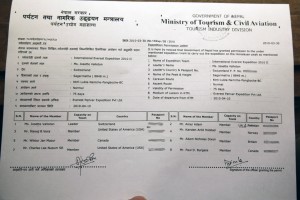
Mount Everest permit

Permission to climb Mount Everest

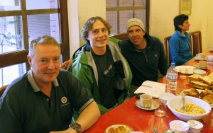
This morning we had a breakfast meeting with all the people that will be climbing Everst South, and there’s 8 of us on the permit, as you can see above. It was good to finally meet everyone, and it seems like we got a good group of people, energetic is one word I would use to describe everybody. There’s also two Finnish guys coming with us that are climbing Lhotse, the 4th tallest mountain in the world, which is done via the same route all the way to camp 4, then we split up and go to our respective mountains. But they’ll be a part of our group all the way!

That’s about it for now. The plan for tomorrow is to head to the airport at 5:00 am and get ourselves on a flight to Lukla, where the hiking begins.

Take care everybody, and until next time!

Chuck, Wiktor, Dan at breakfast briefing

Chuck, myself, and big boss Dan Mazur at today's breakfast briefing

posted by Mike at 19:38  

Monday, March 29, 2010

Everest Itinerary

“Two and a half months? Why does it take so long to climb Everest? What will you be doing all that time?” To answer some of those questions, and to give you an idea of what we might be doing any given week you consider checking this blog out, have a look below at our proposed itinerary. Some comments on it at the end.

Arriving in Kathmandu:

March 30) Arrive in Kathmandu (1300 meters/4,250 feet). Hotel.

April 1) In Kathmandu; visit temples, city tour, shopping and restaurants. Hotel.

Trekking to Basecamp:

April 2) Fly to Lukla (2860 metres/9,400 feet). Walk to Phakding (2650 metres/8,700 feet). Teahouse or camping.

April 3) Walk to Namche Bazaar (3450 metres/11,300 feet). Teahouse or camping.

April 4) Rest and acclimatization in Namche. Happy Easter! Check email, send messages at cyber-café, and eat at one of the many great restaurants in town. Teahouse or camping.

April 5) Walk to Pangboche (3750 metres/12,300 feet). Participate in a Buddhist Puja blessing ceremony with the local Lama at the monastery if you wish. Teahouse or camping.

April 6) Walk to Pheriche (4250 metres/13,900 feet). Visit the Himalayan Rescue Association health clinic. Teahouse or camping.

April 7) Walk to Dugla (4600 metres/15,100 feet). Teahouse or camping.

April 8) Walk to Lobuche (4900 metres/16,100 feet).

April 9) Walk to Gorak Shep (5150 metres/16,900 feet). Teahouse or camping.

April 10) Walk to basecamp (5000 metres/17,400 feet).

April 11) Rest, organization, and training day in basecamp.

April 12) Rest, organization, and training day in basecamp.

Climbing Everest:

April 13) Climb partway to camp 1 at 5800 metres/19,000 feet. Return to basecamp.

April 14) Rest in basecamp.

April 15) Climb to camp 1 at 5800 metres/19,000 feet. Return to basecamp.

April 16) Rest in basecamp.

April 17) Climb to camp 1, sleep there.

April 18) Walk to camp 2 at 6200 metres/20,300 feet, return to camp 1, sleep there.

April 19) Return to basecamp.

April 20) Rest in basecamp.

April 21) Rest in basecamp.

April 22) Rest in basecamp.

April 23) Walk to camp 1. Sleep there.

April 24) Walk to camp 2. Sleep there.

April 25) Rest in camp 2.

April 26) Explore route to camp 3 (7300 metres/24,000 feet), return to camp 2, sleep there.

April 27) Return to basecamp.

April 28) Rest in basecamp.

April 29) Rest in basecamp.

April 30) Rest in basecamp.

May 1) Walk to camp 1, sleep there.

May 2) Walk to camp 2. Sleep there.

May 3) Rest in camp 2.

May 4) Walk to camp 3. Sleep there.

May 5) Descend to camp 1 or camp 2. Sleep there.

Rest in Basecamp or Descend to a Lower Village:

May 6) Return to basecamp.

May 7) Rest in basecamp or descend to a lower village such as Pangboche.

May 8) Rest in basecamp or a lower village.

May 9) Return to basecamp from lower village. Rest in basecamp. Happy Mother’s Day!

Summit Attempt:

May 10) Walk to camp 1, sleep there.

May 11) Walk to camp 2, sleep there.

May 12) Walk to camp 3, sleep there.

May 13) Walk to camp 4 at 8000 metres/26,200 feet, sleep there.

May 14) Attempt summit.

May 15) Attempt summit.

May 16) Return to camp 2, sleep there.

May 17) Return to basecamp.

May 18) Rest in basecamp.

May 19) Rest in basecamp.

May 20) Rest in basecamp.

May 21) Rest in basecamp.

May 22) Walk to camp 2, sleep there.

May 23) Walk to camp 3, sleep there.

May 24) Walk to camp 4, sleep there.

May 25) Attempt summit.

May 26) Attempt summit.

Going Home:

May 27) Return to camp 2.

May 28) Pack up camp 2.

May 29) Return to basecamp.

May 30) Pack up basecamp.

May 31) Pack up basecamp.

June 1) Trek down to Pheriche. Camp.

June 2) Trek down to Pangboche. Teahouse or camping.

June 3) Trek to Namche, Teahouse or camping.

June 4) Trek to Lukla. Teahouse or camping.

June 5) Flight to Kathmandu. Hotel.

June 6) Extra day in Kathmandu, in case of delay, and for sightseeing, gift shopping. Hotel.

June 7) Fly Home. Thanks for joining our expedition!

Of course this is just a proposed itinerary. The only thing 100% sure about this itinerary is that we will not follow it. Too many things vary from year to year to predict the detailed movements. But it’s an idea.

Another issue with this itinerary is that it proposes we cross the Khumbu ice fall at least 5 times up and down (it is between Base Camp and Camp 1). I have heard that some expeditions have changed their acclimatisation strategies to not cross the ice fall that often, as it’s the most dangerous part of the route. We’ll see what our plan is.
posted by Mike at 17:02  

Friday, March 26, 2010

Here I go again on my own

Going to climb Everest is one of those things that not many people are going to attempt. That means those of us that do usually have to go on our own and join up with a group once we get there, a group of people we know nothing about. That’s one of the hardest parts, leaving all behind and heading out on your own. It gets better once we all meet up in Kathmandu, and start talking to people that have the same goal as us. But until then I’m on my own, and for me it’s a bit of a difficult part! I usually end up getting this White Snake song stuck in my head, I find it’s surprisingly fitting for this occasion. I’ll share some lyrics below, though it’s better if you hear the song:

I don’t know where I’m going
But, I sure know where I’ve been
Hanging on the promises
In songs of yesterday
An’ I’ve made up my mind,
I ain’t wasting no more time

Here I go again, here I go again

Tho’ I keep searching for an answer,
I never seem to find what I’m looking for
Oh Lord, I pray
You give me strength to carry on,
‘Cos I know what it means
To walk along the lonely street of dreams

An’ here I go again on my own
Goin’ down the only road I’ve ever known,
Like a drifter I was born to walk alone
An’ I’ve made up my mind
I ain’t wasting no more time

I’m just another heart in need of rescue,
Waiting on love’s sweet charity
An’ I’m gonna hold on
For the rest of my days,
‘Cos I know what it means
To walk along the lonely street of dreams

Here I go again on my own
Goin’ down the only road I’ve ever known,
Like a drifter I was born to walk alone
An’ I’ve made up my mind
I ain’t wasting no more time

posted by Wiktor at 17:32  

Monday, March 22, 2010

Dehydrated foods taste bad

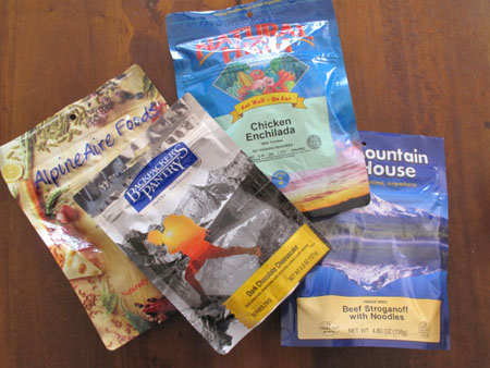
In preparing for my Everest climb, one of the few things I still need to arrange is to have some food to take with me. While most of the food along the expedition is included, once we get to the high camps we have to rely on food we brought and carried up ourselves. Now, the problem with normal food is that a few days worth of it in your backpack can easily be a lot of weight. So one approach is to buy food that is dehydrated, which weighs very little, and you just add boiling water to a package and the contents are ready. Nice solution! The problem with that is it all tastes like crap!

But then again, everything tastes like crap when you’re at altitude. And I have only ever tried dehydrated meals at altitude. In fact, I thought they taste so bad that on my last trip in the Himalayas I could not even make myself open a package and try it. Mentally I was just so disgusted with the prepared dehydrated meal that would be the result that I was getting sick just thinking of it. So I just left them and snacked on other things instead.

In hoping to eliminate this mental block I thought I would prepare some dehydrated meals here at home, where they would come out better, and give them a try. The guy in the mountain store said this should be done, you should try eating them at home to see what you like and what you don’t. And it makes sense, because here you can boil water at 100 degrees (or close to is), whereas in the high camps on Everest you’re lucky if your water boils to 70 degrees. So the meals can be prepared better here.

Anyways, I just tried that with this one meal, and I had to throw half of it out. It was horrible. And while it sucks, I know I’m not alone. I’ve met at least one other accomplished climber who never touches dehy meals. It takes a bit more creativity and planning and thought to put stuff together, but it’s possible. I’m still working out what the best things are, it’s one of the things that I am finding is hardest to learn from one expedition to the next. I may not get it right for this trip but I’ll be closer than last trip. Wish me luck!

Dehydrated Meals

posted by Wiktor at 8:46  

Friday, March 19, 2010

I’m on Twitter

TwitterI just recently signed up for Twitter, if you want to follow me on it you can find me under wik2010, or you can see my updates at http://twitter.com/wik2010. I think it just might be my best way to keep people updated with what’s going on on Everest. As long as I am able to have some kind of internet or SMS connection while on Everest (and apparently there is cell service at least in base camp), I will try and update what I’m up to with Twitter. So check there first if you want to know what I’m up to!

That’s all you really need to know. But I’m also going to say a few words about Twitter. As long as I have known about it I thought it was one of the stupidest things on the internet. I had no idea why it was becoming popular! And I don’t think I am quite convinced yet, but I can see some potential in it. I think for everyday people it’s not that much use, if what people are sharing is what they’re up to. But for people like celebrities or artists or athletes or anybody that has fans, I can see how hearing from your star and knowing what they’re up to can make people think they’re that much closer. And without having to stalk them.

My reason for using Twitter is to capture those instantaneous emotions as I’m going through the ups and downs both literally and emotionally. It would be good to be able to stop for a water break, whip out my phone, and tell you how much I hate my life at that particular moment. We’ll see how good the connectivity is, but that’s the idea. Usually by the time I get a chance to sit down, rest, and compose my thoughts on paper or blog entry, I have averaged out some of those emotions, and it doesn’t come across in quite the same way.

So keep your eyes on that, hopefully it will be of some use. One week until I leave for Everest, emotions are a mix of many, including excitement and nervousness!

posted by Wiktor at 11:52  

Wednesday, March 17, 2010

I made another video

CIRA contest logoI made a little video clip that I posted on youtube to enter a contest; this contest was organized by the the people who run .ca domains. It was meant to answer the question: how does your .ca domain benefit you? So I took that as an opportunity to show off my worldpeak.ca site, maybe I can get the word out a little better and get some traffic to the site, maybe leading to some donations! Anyways, have a look at it if you want, I show some footage from my Cho Oyu climb along with some new footage of what I’m doing to train for Everest. I thought the video was not too bad, but when I look at it on a new day I realize it is still pretty amateurish, but oh well!

Link

We’ll see if it makes it to the final round, but either way I hope it can generate some interest. 9 days to Everest, and Happy St. Patrick’s Day to everyone!

posted by Wiktor at 21:29  

Friday, March 12, 2010

North vs. South

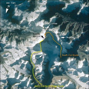
I will be attempting to climb Mt. Everest via the southern col route, or southeast ridge route, which is in the country of Nepal. The other main route is the northeast col route, via the northeast ridge, which lies in Tibet (or China). You’ll generally hear people talk about them as either the North route and Chinese side, or South route and Nepali side. There are of course other ways up the mountain, you can go up whichever way you like, but if you’re not going up either of these two routes it’s because you want more of a challenge.

Everest Routes as seen from space

The first step in climbing Everest is deciding you want to go. The second step is deciding which route you want to take. I just thought I would go over some of the pros and cons of each side, and why I chose the side I did. Know that this is based on what I have heard and read (and I have asked a lot of questions about this of our leader Arnold, who has climbed on both sides), but obviously I haven’t yet been on either route.

Getting to the base camp on the North side means driving in. A while back when the Chinese were trying to put some of their own people to the top they made a road that goes all the way into base camp, and then paved it to put the Olympic torch onto the summit. Getting to base camp on the south means hiking in through the Khumbu Valley, which is supposed to be a very beautiful hike in, and worth the trip by itself just to hike into base camp. This takes about 10 days because of the need to stop and take rest days to acclimatize to the altitude. The Nepalis have made a national park of this area so roads are not going to be constructed anytime soon.

The North side is generally considered colder, as it sees less sun, whereas the South side can get decently warm when the sun is out. It’s a major consideration for some, especially those more susceptible to getting cold in their extremities.

The route itself is considered easier on the North side up to camp 4, where you sleep before summit day, but above camp 4 there are three technical sections (known by their imaginative names as the First, Second, and Third Steps) that catch a lot of people unprepared. This then creates the opportunity for people with limited technical competence to get quite high, then have trouble on the toughest sections, on the toughest day, and create traffic jams for everyone else. On the South the route apparently gets a bit more involved early on, and while it also has it’s technical section on summit day called the Hillary Step that can cause traffic jams, if you’ve gotten there already you have a decent chance of making it over without causing too many problems for others.

Then there’s the location of Camp 4, the highest camp before the summit. On the North side it’s at 8300m, which is the highest camp on earth! This means you have to spend a night at this altitude before trying for the summit. On the south side the camp is a little lower at 8000m, where you still need to sleep on oxygen, but it’s that much lower. However, that also means that you have 850m to climb to the summit from the South, and only 550m from the North; therefore summit day takes significantly longer from the South, but as stated above it is technically not as involved.

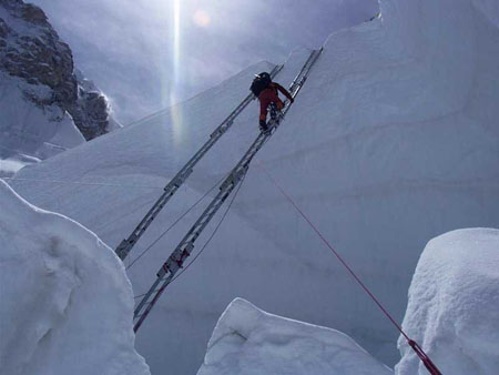
Another consideration is the famed Khumbu Ice Fall on the South, where you have to cross large bottomless crevasses via ladders strapped together end to end. It is the most dangerous part of the ascent via either side, and it’s for this reason alone that some people choose to climb from the North. The problem is that the ice fall is continuously moving, and while navigating through it there are chances that pieces will break off, onto people or break ladders that people are on. To me it’s the kind of risk you can do almost nothing about (other than avoid it by going the North route), as it becomes a lottery for who might or might not be affected.

Khumbu Icefall, Photograph by Olaf Rieck

One last difference is price. The Northern route is generally cheaper. This is because of logistics and getting people and supplies to base camp is done all by car. On the South, people and supplies are first flown from Kathmandu to Lukla, then people hike and supplies are taken by Yak to base camp. All this takes time and money. There might be a slight difference in permit price too, but I am not exactly sure.

So why did I choose the South side? Several reasons. I have heard such good things about the hike to base camp through the Khumbu Valley that I wanted to experience that myself. Getting to base camp from the North involves a drive that I have already done, as it’s almost the exact same approach as getting to Cho Oyu base camp. Another reason is that I would like if the people that are climbing around me on summit day have earned their place, and are not going to be caught off guard by the technical sections and cause traffic jams.

But the main reason is a difference that I only slightly touched on above, and that’s the attitude of the countries in which these two approaches lie. China made a road. Nepal made a national park. China has been known to limit access across the border when things in Tibet start heating up. If I can help it I will put my money into the country that is doing things the way I support, and not politically oppressing the region I am climbing in. But that’s a whole other story that I won’t get into.

So, what side would you choose? 🙂

posted by Wiktor at 11:39  

Thursday, March 11, 2010

What are the odds I’ll die on Everest?

I thought I would answer a question that might be on some people’s minds. I have been asked this question several times, and while mostly people say it jokingly, not expecting a real answer, I realize that it is a legitimate question. And I realize they do mean it, as “a lot of truth is said in jest”. Believe it or not, such a question does not bother me; I realize that what I’m going to do is potentially dangerous, and I have accepted whatever that risk may be. But I also know that it’s not that great of a risk.

The easiest way to answer that question is to check Wikipedia’s article “Eight-thousander”, which lists all 14 of the world’s peaks above 8000m, and gives some stats on them. Taking a quick look at Everest shows that since 1990, the death rate has been 4.4%. So, that means there’s more than 95% chance that I’ll be coming back, right? 🙂 That’s pretty good odds!

But actually it’s not quite that easy. Those numbers are out of date (Everest now has over 4500 summits by over 2800 different people), plus, for lack of data, they take the death rate as Deaths/Successful Summit, rather than Deaths/Attempt. Luckily, there is a database out there that is more up to date and more complete, it’s called the Himalayan Database, and it’s the archives of Elizabeth Hawley, a journalist that traveled to Kathmandu in 1960 and decided to stay there for good!

Himalayan Database

Anyways, depending on what time range you pick, the values of course differ, but if you take the last 20 years like Wikipedia does (1990-2009), or the last ten years (2000 – 2009), the death rate on Everest per person that showed up to climb above base camp is in the 1.5% range. For example, in 2009 there were 5 fatalities, a German, a Czech, a Chinese man, and two Nepali Sherpas. And there was almost 400 people with permits to climb above base camp.

I would like to think those odds are reasonable. I don’t have any stats for what is the likelihood someone will die in a car accident, or from a certain disease, so it’s hard to compare. But I definitely don’t feel that my life is at stake with every step I take. At the same time, on Everest there are no guarantees. A bad year with weather might mean more people don’t come home; good weather might mean more make the summit. Although the odds are in everyone’s favor, someone has to make up that 1.5%. Is that acceptable? That becomes a personal decision for everyone… And what about other effects, such as losing digits due to frostbite?

Anyways, that’s all I’ll dwell on this topic. It’s not something I focus on, but it is something I am aware of, and I think most people would be surprised at how good those odds are. Obviously the most newsworthy trips up Everest are the ones where someone doesn’t come home, so that’s what people tend to hear and that’s what they tend to associate with the mountain.

posted by Wiktor at 8:11  

Tuesday, March 9, 2010

My Road to Everest

“Wow, you’re climbing Everest? You must be a really experienced mountain climber then!” That’s what I hear from people when I tell them what I’m doing this spring. I will admit I don’t think that’s quite the case, so I thought I’d share a bit of background that has brought me to this point.

Unlike some people, I never had any childhood dreams to go climb the tallest peaks in the world. However, I seem to remember quite well moments in my childhood when topics of the tallest mountains in the world came up: in the 90’s some show discussing the controversy between which mountain is taller, K2 or Everest; 90’s again, a fellow boy scout saying how he’s going to go to Everest base camp with his dad one day, and how K2 is actually harder to climb than Everest, which he might try as well. In 1998 (Grade 10) my high school religion teacher Dave Rodney gave us a slide show on his trip to Everest, he didn’t attempt the summit as he was in charge of base camp communications. He would summit another year and come back in my Grade 12 year to give another presentation with pictures from the top this time.

Chilling on Mount Fisher's Summit with FriendsNone of these things ever meant that much to me, spoke to me, inspired me to go climb. I never really got into wall climbing or anything like that; though I did seem to like climbing trees as a kid! During University I would just go do some hiking in the mountains with friends, some skiing in the winter, the thing most young people do growing up in Calgary. The hardest “climbs” I did were really just scrambles of (the now relatively easy) Mt. Yamnuska and Mt. Fisher. But it was enough to make me think I knew what I was doing in the mountains.

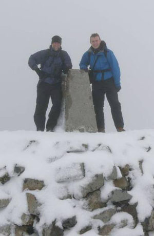
Ben NevisAfter University I got a job, and not long after starting in Calgary they sent me on an assignment to Aberdeen, Scotland. Some Scots are quite outdoorsy people, they’re really into hiking, and for some reason I thought to myself, “I’ve done some decent hiking in Canada, I’m gonna go and try the best that Scotland has to offer!” (That one little thought would take me further than I ever though possible.) Knowing I had been as high as 2846m on Mt. Fisher, I thought I would give Scotland’s tallest mountain a go, Ben Nevis at 1344m. (By this time my blog was in full swing, so you can have a blast from the past and read my quick entry about Ben Nevis here.)

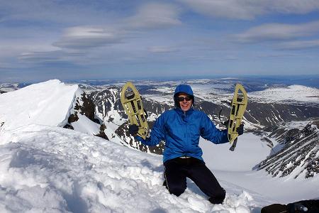
While working in Aberdeen I was working on an offshore platform, which meant I was stranded on a welded piece of steel in the middle of the ocean for two weeks at a time, but would then have two weeks off between shifts. Those lonely days on the platform I spent planning my next trip, so I knew I was heading to Sweden next. And going to a country to try and climb their tallest mountain seemed like a better reason to head there than just to go, stay in some hostels, and do the typical touristy things. So, next on my mountain list was Kebnekaise, the tallest peak in Sweden at 2111m. I suggest you take another trip down my memory lane and read about it here, as you might notice that my hikes are starting to take on a pattern of me biting off more than I can chew, and already I am starting to compare my experiences to what I have heard about Everest.
Kebnekaise

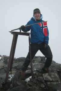
GaldhopiggenAfter Sweden I was headed to Norway, and having been a little sketched out in climbing Kebnekaise solo before the mountain opened for the season, I joined a group that would climb Norway’s two tallest mountains, as well as one of their most famous ridge walks. No blog entry on this, as being more prepared this time and going with a group, the trip just wasn’t that epic, though it was not without it’s difficulties. That brought me to Galdhøpiggen, the top of Norway, 2469m above sea level.

(Note: Looking back at the posts I wrote back in those days is quite entertaining! It is funny to read what I was feeling and thinking a few years ago, and reminisce those days… It is encouragement for me to write as much as I am now, even if for no one else’s benefit, then for my own a few years down the road.)

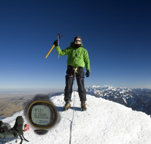
Huayna PotosiMy work placement in Aberdeen was ending, and my next placement would be in Bolivia! Wonderful Bolivia, with some absolutely enormous mountains by any standards in their Andes. My goal while there was to climb up to 6000m, higher than anything I have ever attempted before. I managed to do that in climbing Huayna Potosi, at 6088m, also known as the “easiest 6000er in the world”. It was, and continues to be to this day, the hardest mountain I have ever climbed. All because I was just so unprepared for what to expect. I never did write about this in detail, but it was one of those things that I was sure would turn me off of mountain climbing forever. Luckily, my attitude of “what doesn’t kill you only makes you stronger” won out in the end, and I continued climbing. But I still think that nothing I have climbed since then has had as big of an effect on me, and I wouldn’t be surprised if even Everest won’t stir those same emotions.

As my time in Bolivia was ending I wanted to do one last thing in the Andes, and that was to climb the tallest mountain in the Americas, and tallest outside the Himalayas, Argentina’s Aconcagua. Also known as a relatively “easy” mountain, I knew better than to think that way this time around. Climbing that brought me to 6962m; you can read about it here and follow the posts, as I wrote a number of them; or if you read just one, read this one, where I talk about the summit push.
Ryan and me on Aconcagua

I will admit that while we were still on Aconcagua, my sights were already set on Everest. I thought it might be cool to one day get a chance to climb the world’s tallest mountain. What I had learned in the last couple of mountains definitely made me think I might have a chance one day. I talked to our guide Ryan about that, and mentioned to him that summitclimb, the group I had signed up to climb with, assumes that Aconcagua is preparation enough to attempt Everest. He suggested otherwise, saying I should try another 8000er instead, specifically Cho Oyu. It was also on Aconcagua that I met people climbing for charity, and that planted the seeds that I am now hoping will bear fruit. But let’s not get ahead of ourselves…

Known as the “easiest 8000er”, Cho Oyu was my next step. Now you might see a trend in the mountains I have been attempting, that they’re all the easiest of their groups! But just as I learned on the “easiest 6000er”, those names are very misleading. At 8000 meters, I can tell you nothing is easy. Cho Oyu was my last test to see if I could have a chance on Everest, and to see if anything that happened there might dissuade me from climbing it. You know the results because, well, here I am. I wrote a bunch about Cho Oyu, if you’re interested here’s a link to the first post, and you can read all along to the last one.
Cho Oyu

So that brings us to Everest, and in about 18 days I will be on a plane, pushing my limit that much further. Thanks for everyone’s support and encouragement so far, I’ll be taking it all with me as high as I will get!

posted by Wiktor at 11:34  

Saturday, February 27, 2010

I just got laid off

So a bit of a different topic today, but one that has an effect on my Everest preparation and climb. The company I have been working with for almost 4 years is trying to sell their Canadian assets, and so is slowly closing the Calgary office, letting people go. I got let go earlier this week, and even though I saw this coming for a while, it was still an emotionally draining day. Anyways, I won’t dwell on it too much, other than to say that I’m taking it all as a positive: I will have more time to prepare for my trip and make sure everything is in place that can be! I’ll re-focus specifically on the fundraising side to get people and hopefully companies involved in raising money for World Vision! Remember, you can donate here.

The other reason I bring this up is to lead into my next post, where I’ll talk about how I got into climbing and what experience I have that is now taking me to Everest. You might be surprised how recently I got into mountaineering, and it was almost all due to the opportunities that I got with my company. I can confidently say that BG (and the people I met along the way) have made me who I am today. Stay tuned!

posted by Wiktor at 4:57  
« Previous PageNext Page »

Powered by WordPress